
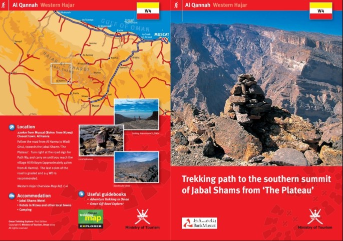
The highest mountain in Oman via trekking trail W4, Friday 26th October 2018.
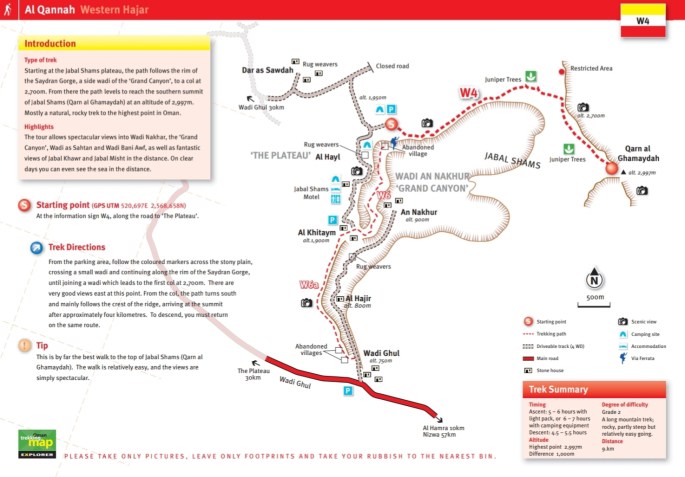
Prior to undertaking this task, a great deal of planning was done. This entailed researching the route, looking online for previous blogs, checking the total distance and duration, the supplies we would need, the time we would need to depart and how long it would take to get there. The main tourism leaflet explained it would be a 9km trek with it taking between 5-7 hours each way. We estimated that it was a little longer and more like 10km each way, so using Naismith’s rule, which is travelling at 4km per hour and 10 minutes per 100m elevation climbed, it shouldn’t take any longer than 10 hours. Our aim was to step off for 0800hrs, giving us a 10hr window to be back for 1800hrs knowing it got dark between 1800hrs and 1815hrs. We had head torches packed should we need them. Most posts read were saying that it is best to be done as a two day hike; camping on the route and doing it slow time. We decided it was more than doable in a day.
The day of the trek started at 0430hrs, reveille, followed by a quick wash and some breakfast. We packed the car with frozen water and supplies to last us the day. Departing at 0530hrs for a 2hr drive to get there in good time for stepping off at 0800hrs. We arrived at 0730hrs on schedule, parked up, adjusted our kit and put on our boots and stepped off at 0755hrs, 5 minutes ahead of schedule.
Before stepping off we noticed the summit, which was just visible way over as far as the eye could see, was in cloud cover. The weather report said we were in for a dry day, losing heat as we gained elevation with little to no wind. We discussed that the cloud cover will have potentially burned off before we got there.
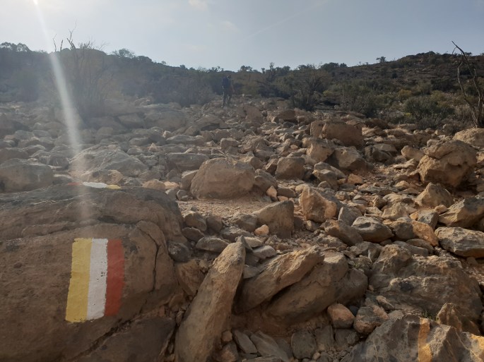
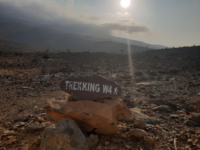
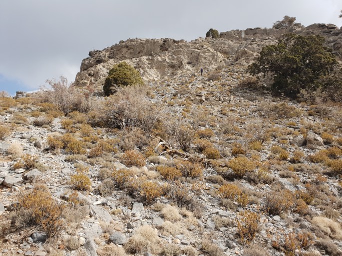
Once we had set off the first thing that became apparent on the trail was some spray painted flags on rocks denoting the route, every 10 to 20 meters. This was very well marked out and easy to follow, directing us up onto the high ground. The route took us along a ridge with amazing views.
Our group consisted of 4 members, all mountain leaders in training (MLT) qualified. One of the members (Tash) kept walking off, rushing the pace, losing the track, whilst the remainder of us kept to Naismith rule, picking the track out and directing Tash from behind. There came one point where Tash took a complete different route and we had no line off site with him for a good 10 to 15 minutes. Once relocated I had a word explaining the importance of group management and staying close to the group in case an accident should occur and group management in this environment is paramount. He took the points on board and remained in line of sight for the majority of the trek up. This member also argued that Naismith rule is outdated and nobody uses it nowadays and his preferred method is to just guesstimate. To the rest of the group this showed his lack of experience and level of maturity, highlighting red flags which we monitored closely.
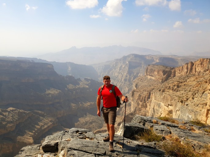
Once getting to the main view point of the trek, we stopped for lunch and re-evaluated the rest of the hike. We came to the assumption that there was still approximately another 3km left to the summit and we had already covered 8.5km. We knew that this could potentially jeopardise our 10hr time frame. We had been hiking for approximately 5 hours at this point. So with an extra 3km to the top, we calculated an extra hour. So, if it was to take 6 hours up and 4 down we would still make it down before nightfall. We pushed on with constant reassessment.
After approximately 1.5km or 30 minutes of trekking we came to what looked like the summit, but to get to it we had to descend 100m to gain another 150m . This was the point the older member of the team (Grandad) who had been out hiking the previous day decided he didn’t want to push any further. He wanted to conserve energy for the route back. We had a discussion on what plan to take. Grandad said he would be ok to stay where we were while we pushed on to the summit and that he would start to descend once he saw us return to get a head start. We all made sure we had working head torches just in case it took longer than anticipated and came to a mutual agreement that if we had to spend the last leg under head torch we would be able to do so safely. I had also informed everyone in the group that I was carrying my head torch (the beast) which is a Petzl Nao+, a piece of equipment I highly recommend. It practically turns darkness into daylight. With this decision being made the rest of us pushed on for the summit.
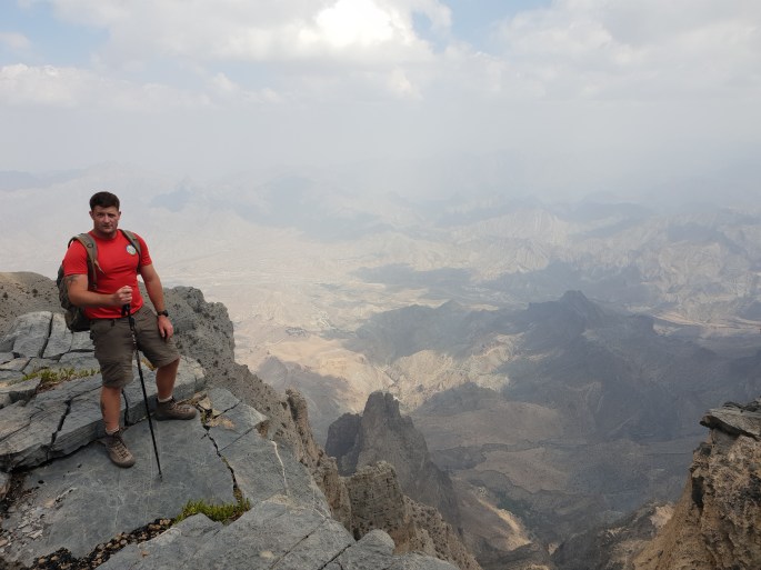
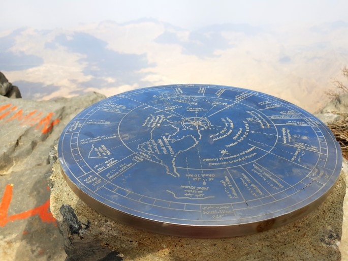
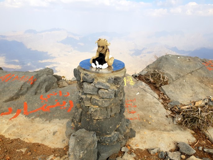
Descending the re-entrant and ascending it again was hard work, with more undulating ground ahead, that final km was hard work. The effects of being at almost 3000m altitude were becoming more apparent. These noticeable affects was mainly on the respiratory system due to it becoming more anaerobic, it felt like each breath was lacking in Oxygen. Also present was a mild headache, this wasn’t alarming as having experienced being at this kind of altitude before, I had a good understanding of which affects I could be potentially experiencing. Surprisingly enough, we didn’t suffer with any light-headedness or dizziness. After pushing on and approximately 30 minutes after leaving granddad we reached the summit at 1430hrs. We stopped for 15 minutes to soak in the views, take some photos, have a snack and take on some fluids in preparation for our descent.
We started our decent at 1445hrs, with the vision of it taking roughly around 4-5 hours to descend; at this point we knew we would be finishing the trek in the dark. We didn’t let this phase us though; the descent is just as important or even more important as the ascent. This is due to accidents occurring through complacency, fatigue, lack of concentration. The biggest risk on this descent would be to try and rush to the bottom before daylight ended. So we all agreed to not rush and head down safely without worrying about getting back before dark.
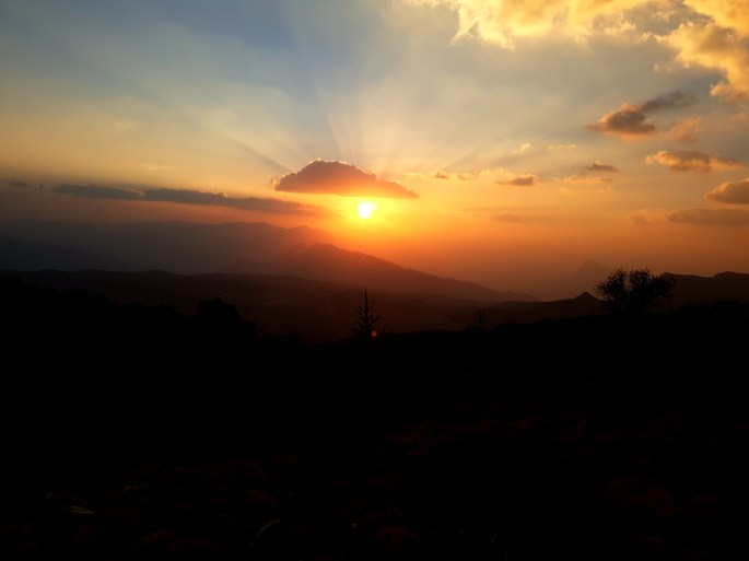
Whilst on the descent we had a discussion as to where the sun would set and whether or not we would get to see it. After a quick navigation check I called it and said yes we would see the sunset, regardless of the cloud cover we had. I was asked to give my word on that, so I did. We progressed down the mountain as quickly and safely as we could, making the most of the daylight. At approximately 1730hrs the sun started to set. We stopped, got our head torches out in preparation for the obvious, took some photos of the well-earned sunset, and then carried on with the descent. We felt that it would be probably pitch black by 1800hrs.
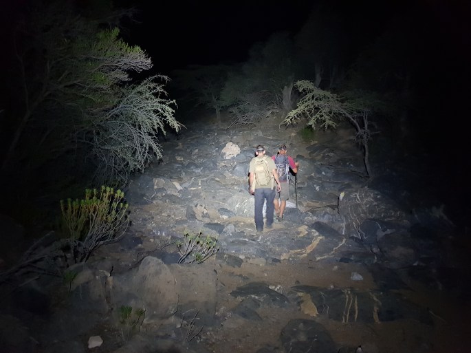
1815hrs was when dusk turned into complete darkness and the head torches were deployed. I asked Tash to close the spacing up as he still persisted to rush the pace. After 10 minutes of still rushing the pace, Grandad asked Tash to close the gaps as he wasn’t keeping line of sight. Tash still proceeded to do as he wished, so some stern words was exchanged from myself to Tash, explaining that if he wishes to progress in the mountain leader (ML) scheme, then he seriously needs to go away and rethink his group management skills, teamwork skills and people skills, otherwise he will fail. This was backed up from the rest of the group. Tash took these points on board and although still insisting on pushing the boundaries of how far in front he wanted to be, he did help by giving detailed descriptions of the risks such as lose ground and boulders ahead. The beast performed exceptionally well, I stayed at the rear of the group lighting the ground ahead for the other members making it a very effective, enjoyable and a well conducted final leg of descent. Approximately 1hr of the descent was in total darkness.
Before getting in the car to head back, we stretched off, changed our kit, took on some fluids and snacks and decided to head to a food complex to grab a bite to eat on the journey back. My choice of food was Pizza Hut. Yum yum!

The total duration of the hike was 11 hours and 15 minutes, 23.5km in length and a total of approximately 2500m of each ascent and descent. Overall, one heck of an epic trek.
